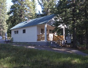
Thursday evening after work, David and I loaded up tent, sleeping bags and ATVs before heading south to the east side of Boulder Mountain (again) south of Torrey Utah. Before midnight we had set up camp at the Oak Creek Campground on the east side of Boulder Mountain and were enjoying a beautiful cool evening. By morning it had turned from cool to “find-a-jacket” cold.
Friday morning we were ready for an eggs and toast breakfast but because we had forgotten to pack a frying pan, we had cold cereal instead. We then loaded up our camp and drove a few miles down the Oak Creek road to a clear area in the woods where we could unload the ATVs.
Once on the ATVs, we headed east and soon joined the trail that we had taken several weeks earlier that took us back down Oak Creek. We wanted to go back and check out several of the possible natural arches that we had seen on the last trip. Unfortunately, that also required that we revisit the same spot in the trail where I had rolled an ATV two week earlier.
The trail into Oak Creek was almost as bad as I remembered it. From the campground manager, we heard that an ATV club had been through there the previous week (Paiute ATV club?) and their traffic may have helped move some rocks around Still there were plenty of those round black rocks and boulders that I have grown to “love”. (Most of Boulder Mountain and surrounding area is peppered with these volcanic blast marbles.)
The trail descends the mountain through levels of aspen and pine, down through a level of Ponderosa Pine and manzanita brush, down further through pinion pine and cedar forest level and ends in the bottom of Oak Creek where desert prevails with cottonwood trees lining the year round creek. I especially like the Ponderosa Pine and manzanita level where the air is most fragrant. However, every major change of elevation requires bumping down a long stretch of black rocks and boulders.
Once down into the canyon part of Oak Creek we stopped to take morning pictures of Oak Creek Arch.
We also quickly explored a side canyon on the north side that took us to a large petrified log about the size of a desk. There is usually a lot of petrified wood lying around in that type of strata but that was the largest whole log I have seen for a while. Most of the other pieces that I saw were about the size of a frying pan.

We then headed back up the canyon to a side canyon to the south that we wanted to hike get a closer look at potential arches we had seen from a distance. This required going back up the trail cut where I had rolled my ATV two weeks before. However, after some quick trail “modifications” to fill the deepest parts of the washed out trail, I didn’t have any problems climbing the cut.
The side canyon that we wanted to hike was not too long but it was strewn with those black round boulders so the hiking was slow. We hadn’t gone too far up the canyon when we found fresh mountain lion tracks. In fact, the tracks were so fresh that the cougar could easily have been right in front of us. Since only “crazed” animals will attack two people, we made a special effort to not get too far away from each other. (Besides, we didn’t have a frying pan to protect ourselves with.)
We first reached a cliff area that I had seen through binoculars on our previous trip. We couldn’t decide whether it was a legitimate natural arch until we were right under it. It was indeed a class C natural arch which we named Butt Ugly Arch.
We tried to continue hiking up the canyon but didn’t go far before we started hitting dry falls. I climbed up the cliff to get around one of them but that didn’t get me much further before I hit another one. I climbed up the cliffs again just to get a look around but there wasn’t much else to see. The only thing that I could tell was that the other arch we were looking for could not be accessed from the canyon. We would have to come back another day and try climbing up to it from a different direction.
It was getting hot and by the time we got back to the ATV’s, we had decided that this was the only hiking that we were going to do that day. We drove the ATVs up the canyon to a small waterfall where we did a little wading to cool off the feet. Ahhhh…..
(We also noticed there were trout in the water. Man, if we only had a frying pan!)
We still had time so after climbing out of Oak Creek, we were able to explore some trails. One of them took us up on Big Ridge which looks out over South Fork of Oak Creek. Soon the jeep trail joined the Blue Grass road which is where we wanted to explore on Saturday.
We did take a trail up on the flats on the south edge of South Fork of Oak Creek. There was a plastic pipeline laid along the trail and we soon found that it fed some stock watering tanks positioned along the flats among the Ponderosa pines. We drove the trail until we could see that the trail was going to continue further than what we had time for that day.
We finally had to head back. I was exhausted from riding and hiking by the time we had the ATVs loaded on the trailer again. Total ATV miles = 30.2 miles.
We then drove down into Torrey Utah and got a room at a motel and a meal at a local cafe. In spite of being tired and not getting a lot of sleep the night before, I still had a hard time sleeping that night. Morning came way too early.
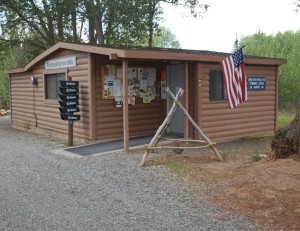
A continental breakfast was provided by the motel so that saved us a little time getting back on the road again. (Besides, we still didn’t have a frying pan.) We drove back up the mountain and made a stop at the Wildcat Forest Service visitor center. We were looking for a particular travel map that included the ATV trails in the area and practically had to beg them to get one of their last few travel maps. Apparently, Forest Service designations are about to be changed so maps will have to be reprinted anyway. In the meantime, they are hard to get.
The next stop was at the trailhead for the Blue Grass and Dry Bench trail. Here we found a number of bow hunters with their camps and vehicles. Apparently, this was the second weekend for the annual bow deer hunt. However, after the first five miles or so on the trail, we had left them all behind and didn’t see another person all day long. (We didn’t have bows but if we had seen a nice buck, we could have thrown our frying pan at it… no, wait…)
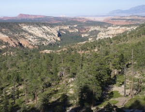
Our first destination was the “pipeline” trail that we had taken the previous afternoon but hadn’t driven to the end of the trail. We were surprised when the trail ended only about a mile further than what we had traveled the afternoon before. The trail ended at a lookout into South Fork of Oak Creek with some views into Bear Canyon.
After back-tracking to the Blue Grass road again, we took the Dry Bench road eastward through many miles of Ponderosa pine and pinion pine forests. In several places, the trail became challenging where the old trail had washed out over past years and new trails had developed around the problem spots.
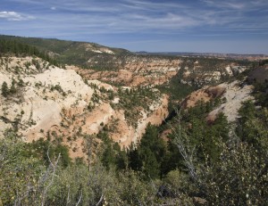
Along the way we stopped for views into the top of Stair Canyon and The Gulch.
Soon we were heading the very top of Bear Canyon and out on Dry Bench where the roads ended at cliffs or at the Capital Reef National Park boundary.
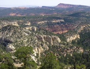
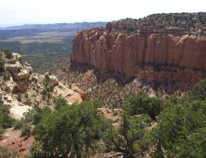
The best view was off the top of the Circle Cliffs to The Lampstand and an area called The Flats, which is called that because the land is flatter than a frying pan.
It was a great ride through some fantastic country but it was also extremely tiring on ATV riders. The wind was picking up and storm clouds were gathering over Boulder Mountain when headed back down the road again.
For some reason, I start getting nervous when we are that far out. The ATVs REALLY take a beating on these type of trails and I wonder how much they can take before something breaks. Breaking down is one thing but breaking down out that far would be a serious problem. If something happened to both ATVs, we wouldn’t be able to hike back for help before running out of food, water and energy.
Unfortunately, something like this happens to someone several times each year here in Utah. Sometimes, the bodies are found within a few days or perhaps a week or two. Sometimes it is years later before a discovery is made. Everett Ruess had been missing since 1934 and they just recently found his body. (3/5/2010 Correction: They have now confirmed through DNA testing that the body they found was NOT Everett Ruess. He is still out there. However, I hear they found his frying pan!)
Anyway, the closer we got to the highway, the more relaxed I felt. As we approached the main roads, we began running into bow deer hunters who were working the roads for the evening hunt. We loaded up the ATVs and headed down the mountain again. Total ATV miles for the day = 35.5 miles.
After loading up with a hamburger and some caffeine in Torrey Utah, we headed for home.
By the time we got to Sigard Utah, we were hitting spots of rain but could smell smoke on the wind. Between Aurora and Scipio, we found out why.
The BLM or Forest Server had been conducting a “controlled burn” in the mountains southwest of Scipio Utah for several weeks now. We had first seen the small fires slowing burning on the side of the mountain when we came through there about four weeks ago. The fires were still there two week ago, just further south on the mountain.
However, the strong winds that had started that day had blown the flames into a major burn with most of the side of the mountain in flames as well as a large wall of flames working through the cedars eastward across the flat country towards the highway (and towards us). It was about sunset and we stopped to take a few pictures of the massive flames ripping up the mountain when a highway patrol office stopped to let us know that they were about to close the road. If we wanted to get through, we needed to do it immediately. We managed to get through without much problem with the smoke.
The fire from the Scipio side looked even bigger. The town of Scipio Utah was completely dark so it was obvious that the fire had taken out the power lines into town. The town looked empty so either people were out helping/watching the fire or they had grabbed their kids and frying pans before making a run for it.
There was a long line of fire engines and emergency vehicles lining the frontage road next to I-15 freeway to keep the fire from closing the freeway or jumping it. Between all of the flashing red & blue lights and the fire flames, it was quite a sight.
However, instead of sticking around to watch the show, we got on the freeway and headed north back to Utah county. In spite of everything, we got home fairly early that night.

