


On November 27th, I took a few days off from work and headed for Page Arizona with David. Our chosen route took us through Kanab Utah.
We stopped at the trailhead for Buckskin Gulch which is part of the Paria River Gorge near the Arizona Border. We found that it now requires a $5 permit to hike into the Gulch now. I was also looking out for an area called Coyote Cliffs and didn’t find out later that was a short distance to the south and mostly in Arizona. I then found out that only small groups guided by a ranger are allowed into the Coyote Cliffs each day. The waiting list for visits to this area is over a year-long now. (Stupid tourists!)
Before driving the last few miles into Page, we stopped in an area just to the east of the Comb Ridge. I had found a nice ‘B’ side arch that I called Condor Arch.
David and I poked around a little and found another one just to the north. To confirm that it really was an arch, we had to climb up the steep slope to be right under it. We named this class ‘C’ arch West Cove Arch.

It was after dark by the time we got to Page Arizona. We finally agreed on a hotel to stay at that seemed reasonably priced. We really didn’t get to check out a complete drive through of Page because a good deal of the main street was blocked off by policemen and fire engines. We found out later that there was a bomb scare near one of the other hotels. As it turned out, our hotel was only a short block away.

The next morning after breakfast, we headed for a dirt road that left the highway near Big Water Utah and headed east along the north side of Lake Powell. We drove out to an overlook of Gunsight Butte and took lots of pictures of the lake below us.


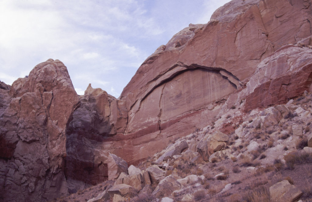
On the way back to Page, we stopped at Wiregrass Canyon and hiked down to a large class ‘C’ natural bridge that connects two canyons.

We then climbed out of the canyon and hurried back to the vehicle before dark. We then headed back to Page and the hotel we had chosen the previous night. (All the hotels were still standing when we got back that night.)
The next morning we headed east, deeper into Arizona. We had to go that way to get to roads that doubled back into Utah on the east side of Navajo Mountain and south of Lake Powell. Down a long gravel road, we passed the Navajo village called Navajo Mountain Trading Post and were surprised to find a larger village that included newer school buildings. Out map showed this to be called Rainbow City but I believe they call this Navajo Mountain town now. There were no stores so I am guessing the closest food and supplies would be at the Navajo Mountain Trading Post.

This is truly one of those hidden Utah places in an area that I would like to explore more. Nearby is the trailhead for the Navajo Mountain/Rainbow Bridge trial that can take you to Rainbow Bridge on Lake Powell. The trail also passes several large natural arches that David and I have been trying to figure out how to get to without taking a week of hiking and camping.
Hawkeye Arch is actually a double class ‘A’ arch stuck in a short canyon, on the south side of Lake Powell and northeast of the Navajo Mountain town. There was a jeep trail that would have got us fairly close but the gate was locked so we ended up hiking across the sagebrush flats for over a mile to get there.

I decided to call the second wall arch “BJ Arch” for the characters BJ and Hawkeye in the M.A.S.H. television series.
The days are short now so we had to hurry back to our vehicle and head back to Page for the night.
The next day we were supposed to head for home. However, we didn’t need to hurry. We drove around Wahweap Marina dn took pictures of Wahweap Window across the bay. Another class ‘C’ arch.

We then stopped at Blue Pools Arch just down the road near Big Water Utah. This was a nice sized class ‘C’ arch.

We also took a detour into the hills northeast of the Paria River entrance. When it was plain to see that the country was going to be that interesting, we turned around again.
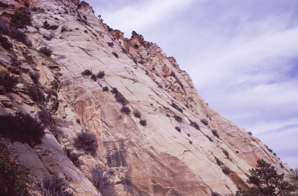
We decided to head home via the road through Zion National Park. We were at the east entrance before we discovered that it cost $10 even if we just wanted to drive through to Cedar City. If it was going to cost us $10, we decided to at least drive around the park and take a few pictures.
Our first stop required a bit of a climb to get a picture of Checkerboard Arch, a class ‘C’ located on the cliffs directly across the canyon from Checkerboard Mesa.
Our next stop was for Twin Butte Arch, a class ‘C’ arch hanging off high cliffs to the north of the park road.

Nearby we stopped again for pictures of Twin Pines Arch, a class ‘B’ arch that we really need to hike to someday.

We were just outside the park and heading to Cedar City when the sunset exploded into a beautiful orange and red display.
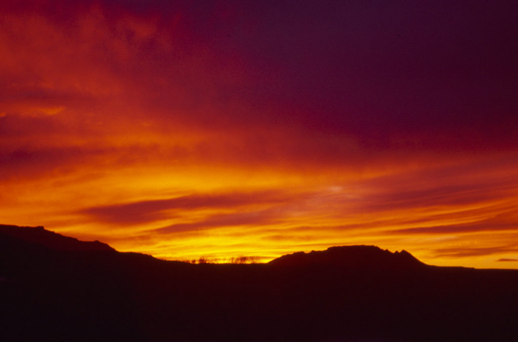
A perfect ending for our trip.