


On Wednesday, August 8th, David and I headed south after our workday ended. We took my tent trailer and managed to pull into the Devil’s Canyon Campground (between Monticello and Blanding Utah about midnight. By about 1:30 AM, we were set up and in bed.
The next morning after breakfast, we were off to Canyonlands National Park Needles area. Along the way, we stopped briefly as we drove through Indian Canyon, just long enough to take a quick picture of Indigo Arch near Newspaper Rock.

After checking in at the visitor center for travel permits for Thursday and Friday ($5 per permit), we headed for Lavender Canyon.
This area of Utah had been getting hit with heavy rains the previous week. This was the “Monsoon” season for southern Utah and some places had flooding in places. In fact, Lavender Canyon was designated as “Not advisable for travel”. We convinced the park ranger that we could handle it so he gave us a permit.
However, even though we had been up Lavender Canyon in wet weather, we weren’t really ready for all the mud. It certainly made for some interesting driving. Convincing the Explorer to go where I pointed it proved challenging. We were flipping mud everywhere! There were several places that could have ended our travel but we managed to power through them anyway.
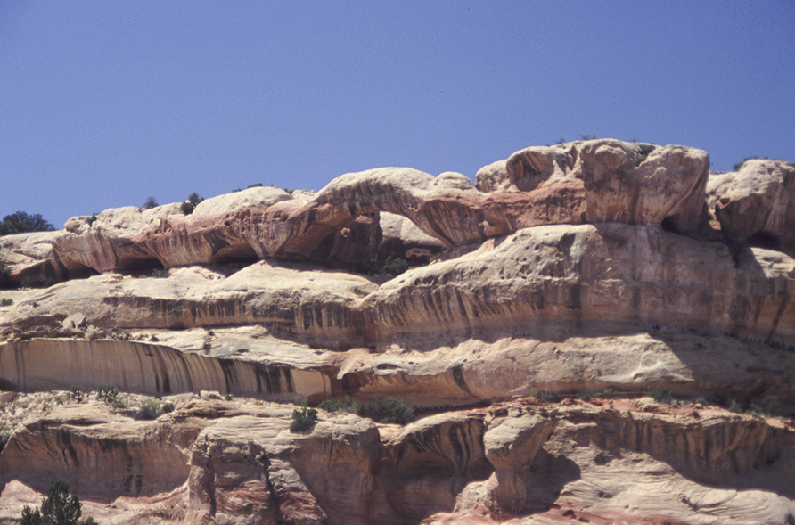
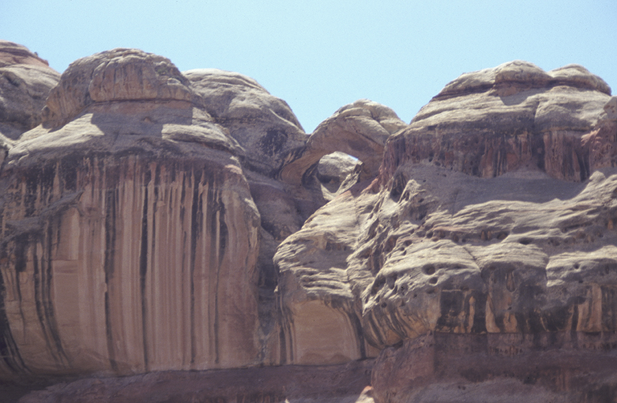
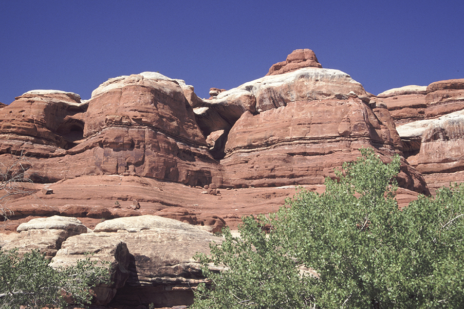
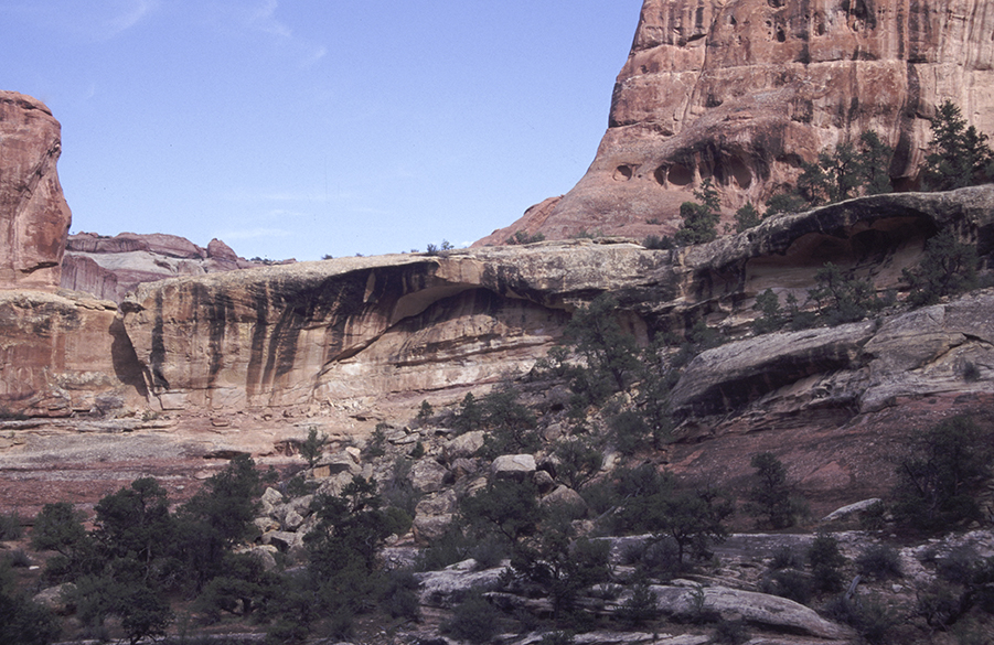
When we finally got into the cliffs part of the canyon, we made stops to take pictures of a number of natural arches.

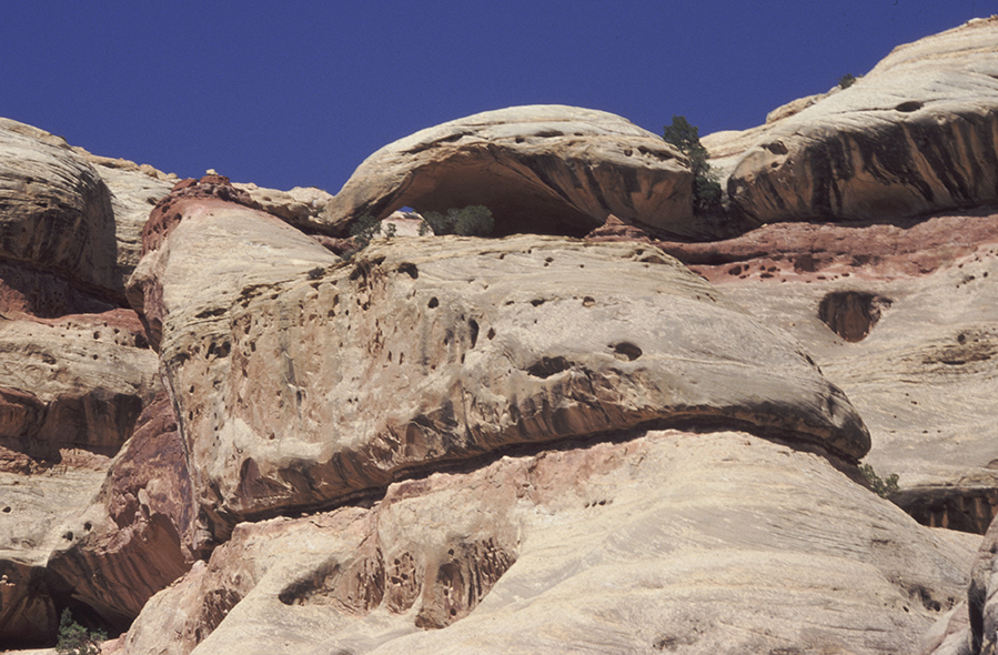
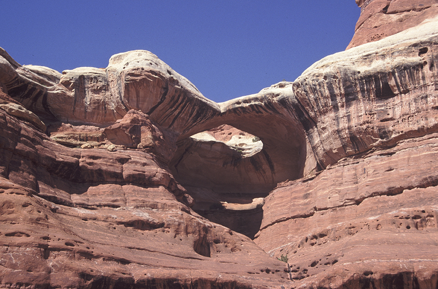
We were heading for the side canyon that contained Turtle Arch and Hummingbird Arch. Here we started hiking up the side canyon to the end where there was a tallus slope that allowed up to climb out of the canyon and then cross a pass over into Davis Canyon. Along the way, we found another natural arch we called Belly Button Arch.

The climb up the talus slope was a ‘gut-buster’ but bypassing all of the upper cliffs turned out to be just as hard.
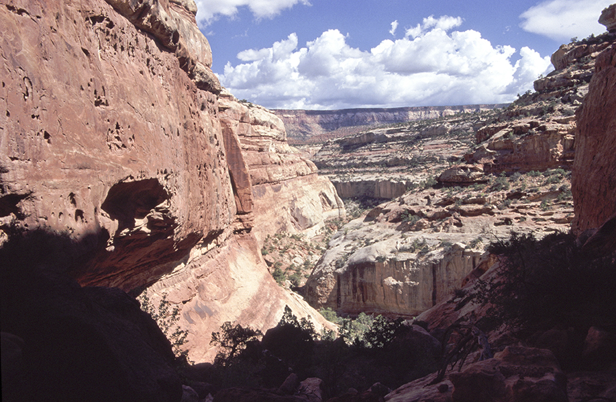
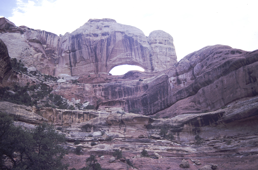
From the pass looking into Davis Canyon, we could see our destination, Gunsight Arch, about a mile to the west. This was one of the really hard arches to find and to get to so I really wanted to see it. We hiked down out of the pass so we could get closer pictures but we found we didn’t have the time to hike the last half mile around in order to avoid a deep wash and reach the arch. Pictures from across the canyon were going to have to do.

It was late in the afternoon before we made it back to the talus slope. Climbing down through the boulder field exhausted us. Somehow, we made it back to the Explorer about sundown and began the long and muddy drive out of the canyon in the dark. It was after midnight again before we were in bed.
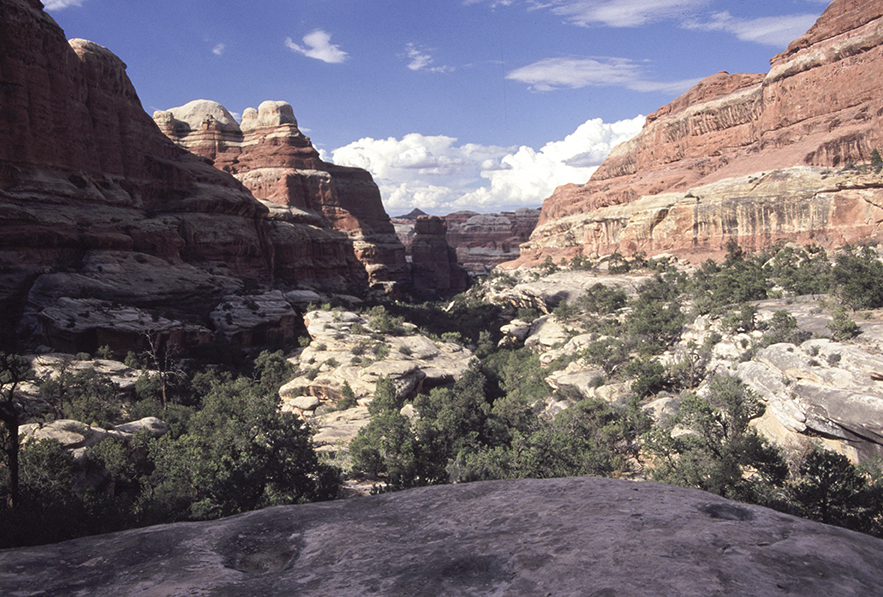
Friday morning, August 10th found us heading back to Canyonlands National Park so we could use our second permit and access Salt Creek. We parked near the mouth of Horse Canyon and proceeded to bush-wack our way to the mouth of a canyon I call Secret Canyon. This is a little known canyon located between Horse Canyon and Salt Creek. On the topographic maps, it is literally hidden in the seams between the maps. We were heading there because I had noticed a natural arch in the distance from Horse Canyon on a previous trip. It had taken us a while to figure it was actually in this secret canyon.
We finally found a path through the thick willows and brush and were soon hiking up the drainage in the canyon itself.
While hiking up the canyon, we ran across some fresh animal tracks also heading up the canyon. For the next several miles we tried to figure out what kind of an animal it is. Not cat-like, not bear-like, not dog-like. Much too big for any kind of rodent. Large wolverine was my best guess. From regular fresh scat droppings, it was plain to see it had been over gouging on the squaw-berries in the lower part of the canyon, which seemed to be causing gastric distress. (You know what they say about “too much of a good thing”.)
The tracks disappeared in the boulders near the head of the canyon and we never did get to see what the animal was. To make matters worse, the arches we located were fairly small and insignificant.
Rats!


[I have since decided that the animal had to have been a young bear, though it did not leave tracks like any bear I had ever seen before.]
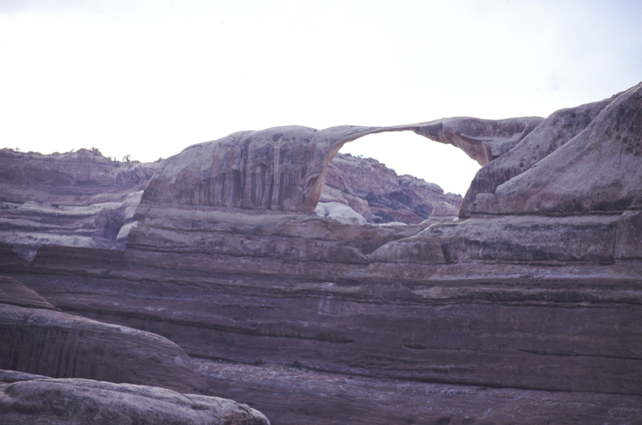
Once out of the canyon, we still had enough daylight to drive up Horse Canyon, taking pictures of natural arches along the way.
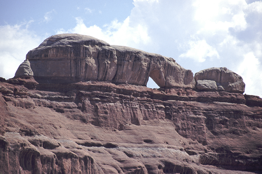
When we hit the end of the Horse Canyon trail, we climbed up the south slope to get pictures of Scout Arch and Fortress Arch. The long shadows were flooding the canyon making photography difficult.
Back down the canyon a ways, we decided to hike east up a short canyon to photograph Castle Arch but the picture lighting was terrible my then.
It was time to leave the canyon.
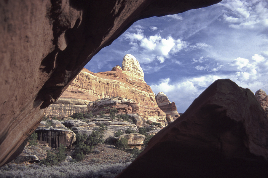

The next morning, August 11th, we drove over to the mountains northeast of Natural Bridges National Park in an area called “The Bear Ears”. We had breakfast on a large flat rock overlooking Arch Canyon at Butts Point.

Above Peavine Canyon it had been raining so the road down into the canyon proved to be scary muddy. Instead, we decided to drive to a hilltop near the top of Peavine Canyon and try to hike to the edge where we hoped to view a natural arch.
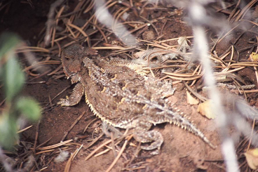
On the way through the brush, I saw the largest horny toad that I have ever seen. It was as big as my open hand!
We finally did locate Queen’s Arch by scrambling around the cliffs and peering over the edge. The better and easier view would have been from the canyon floor.

Sunday we headed home for a much-needed rest.